Thursday, February 26, 2015

A girl can change her mind can’t she?

saying

This has been a crazy week in terms of working on my Amish bed quilt. After I posted last week I decided that I hated it. There were just too many colors all smushed together. I tried a few other things with it and decided to abandon it for now and make something else. I think I will eventually make a lap quilt out of the blocks. It is now packed away so I don’t have to look at it.


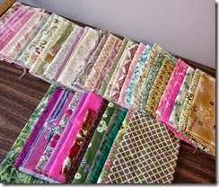
Back in 2012 I won 50 yards of fabrics in the online shop hop. These were one yard cuts of 50 different Art Gallery fabrics. While it was wonderful to win the fabrics they were not fabrics that I would have chosen. I have mainly used them on the backs of art quilts. But 50 yards is a lot of fabric. I decided to try to use up a lot of them in this king size bed quilt for our new house. There are less colors than in my Amish quilt. This is pretty much pinks, greens, some blues, and neutrals such as beige/brown and gray. That is what they gave me. Do you think I should use some yellow?


I decided to try Anita Grossman Solomon's technique to create the arrowhead block. She has shown this in one of her books as well as on her Craftsy class. I want to make this as a blended quilt with low contrast since I like that look. Before washing fabrics I decided to try making a block with some fabrics that I had on hand to see how the technique when and was happy with the results. This is not a block I will be using in the quilt since I did not wash the fabric before making it and I did wash the fabrics for the quilt.

Here is my practice block…it is pretty wild. Using her technique you cut out 2 squares and put them right sides together, sew 2 seams, make 2 cuts and you have all the pieces you need to make the block. It went pretty fast. Of course the quilt would have 121 blocks in it so it will take some time.


Blended quilts are a challenge since the goal is to have low contrast in the blocks and have some blocks with more contrast than others. I have make one other blended wall quilt that I hung for Christmas one year and never took it down. I wish I had made that inner border less dark than it is, but can’t change that now.


image

My husband caught our cat going after my Valentine’s day roses. They are pretty droopy. Check out the sequence of photos. These cracked me up.


image


image

Thanks for reading. Have you changed your mind about a project that was not going well or did you just forge ahead? Have you ever felt like just chucking the whole thing into the garbage? Have you ever done that?

Chris

Linking to Nina-Marie a day early since I won’t be home tomorrow to write this blog.

Monday, February 23, 2015

Weather Monday 2/23/15: Precipitation Part 1

lightning

Lightning in the desert postcard for an exchange.

Imagine that it is mid July and 92 degrees F (33 degrees C) and humid. You hear thunder. Only 3 1/2 miles away it is snowing. Yes I said snowing. How can that be? Is this some kind of Hollywood stunt? No it is not. It is snowing in the cloud!


image A thunderstorm is a particular type of cloud called a cumulonimbus cloud. The bottoms of these clouds could start at about 1000 feet above the surface and go up to 40,000 feet (up where jet airplanes are flying or the height of Mt Everest). It is so cold inside these clouds since parts of them are so high up that it could be snowing inside these clouds. There is basically a weather factory inside the cloud…rain, snow, hail.

This is a photo I took of a cumulonimbus cloud while storm chasing in the Midwest back in 2004.


So with that introduction I am going to begin to talk about precipitation today.

Why does precipitation fall to the ground?

In one word….gravity. Gravity makes snow or rain fall just like it makes all things fall. So why do cloud particles stay suspended up in the sky? Why don’t they just fall? Likewise we could ask why the dish sitting on your kitchen table does not fall to the floor. We have some upward force that opposes the downward pull of gravity. In the case of your dish sitting on the table the table itself pushes upward on the dish to prevent it from falling. Right now your chair is pushing upward on you to oppose gravity that is pulling you downward. You are happily balanced and reading my blog :)

So what opposes gravity in the cloud? It is called the updraft. The motion of the air inside of a cloud is upward and why it is called an updraft. In fact that is how we get a cloud to begin with. Air must rise to create a cloud. Air that rises cools, gets saturated with moisture, and creates a cloud. Air must always cool to reach saturation. That’s why we see fog, frost,dew (which show that the air has achieved saturation) form at night. It gets colder overnight.

Cloud droplets are typically very small…way less than a millimeter. A millimeter is a tiny dot or about the thickness of a dime.  A typical raindrop is much larger. That means that as long as the particles are small the updraft can keep them in the cloud. They have to grow much larger in order for them to get heavy enough for gravity to make them fall to the ground. In other words, gravity has to become stronger than the updraft. This is like you trying to sit on a chair that will not support your weight. Gravity is stronger than the upward chair force and the chair collapses and you fall to the floor. Something similar has been seen in the areas of the USA that have received so much snow. Gravity (the weight of all that snow) gets larger than the upward support from the roof and the roof collapses.

So the droplets inside the cloud due to the upward motion do collide with each other and stick together and grow larger. They can grow large enough to become heavy enough to fall as rain.

image This is how you get big dust bunnies in your house. The tiny dust particles stick together as air currents move them around the room. I swear this photo is not taken in my house!


Types of precipitation

We have liquid and frozen types of precipitation as you can see in this list.

Liquid precipitation

  • drizzle, rain

Frozen precipitation

  • snow, sleet, freezing rain and hail

Today I am only going to discuss the liquid ones. These kinds of precipitation come from relatively warm clouds where there is only liquid water droplets inside the cloud. Snow forms inside a cloud that is colder and has both liquid water and ice inside the cloud. I will discuss that next week.

Drizzle consists of tiny droplets. Raindrops are larger. You can probably guess which one requires a larger updraft to achieve. Did you guess raindrops? You are right! So if there is a weaker updraft then the droplets do not have to grow as big for gravity to overwhelm the updraft. So they will fall even though they are fairly small.

Does precipitation always reach the ground?

The answer is no. If it is very dry below the cloud the droplets can evaporate before reaching the ground. This is called virga. You can see a photo of virga here. See the streaks below the cloud and how they don’t extend to the ground?

Well that is enough for today..Stay warm, my friends in the bitter cold parts of the world. If you are not having cold weather you are lucky. We are getting tired of it.

Thanks for reading.

Chris

Friday, February 20, 2015

A wonderful wall of color!

Well I now have 20 blocks done and 36 to go! This is not necessarily the final location of the 20 blocks that are done, but my entire design wall is filled at this point. I guess I will have to lay out all 56 blocks on my living room floor and hope that no one asks to see my house until I get the rows sewn together. Or maybe I will have to tag them.

I sent the photo to my husband and he said, “That is one eyeful of color.  I started to hallucinate when I stared at it too long!” I guess I am bringing him back to the 60’s.  That’s a good place to be…incense, peppermint…born to be wild…sergeant pepper’s lonely hearts club band…they call me mellow yellow…I could go on and on.


I do wonder what people think when they come through our house and see all of the quilts. I think just about every room has a quilt or 2 on the walls.  Even one of the bathrooms has a quilt on the wall. Plus some are on beds. Could be they don’t even notice….

I ordered and received my border and backing fabrics from 1000 bolts only one nut. They were only $4.99 per yard and look wonderful and are of a good quality. The borders are Bella solids and the backing is P&B textiles. So I hope to be ready to send this off to longarm quilter before long.

Well now to sew some more blocks. Have you ever ordered fabric from 1000 bolts? What is your favorite song or band from the 60’s?

Linking to Nina-Marie. I was shocked when I looked at the latest stats on my blog. I had about 150 hits yesterday and more than 300 today.  I have never had 100 hits or more in a day. So if you have been checking out my blog thanks for doing that.

Weather Monday for 2/23 will be about precipitation…. snow, sleet, hail, freezing rain and rain.

Chris

Monday, February 16, 2015

Weather Monday 2/16/15 Weather Forecasting Part 3: Other methods of forecasting


Wintertime Blues is the name of this quilt. That is what we have in the eastern USA. We are ready for summer, but the forecast looks like more bitter cold and snow. Yikes!

This time I want to talk about other methods of forecasting. Some are easier to do than others. Some of more accurate than others.


Persistence Forecast

This forecast says what it is doing now it will be doing in the future. This would be like what you see in the table below. Boy I wish that were our forecast

Today Tomorrow The day after tomorrow
image image image

This is certainly and easy method, but is only good for very short range forecasts. Weather can change very quickly so I would not put any money bets on a persistence forecast. But it is so easy even my cat could make this kind of forecast!

Guarding the Catnip (or forecasting the weather) Maybe he can do better than the groundhog!


Steady State or Trend

This method is a bit more sophisticated than using persistence and does require knowledge of meteorology.This method assumes that weather systems such as a cold front will continue to move at the speed that have been moving at and in the same direction. This map from ww2010 shows a cold front moving a distance of 800 miles in 24 hours. We would assume that it will continue to move at the speed and in that direction so we know where it will be 24 hours later. Again this is only good for short range forecasts since systems can change speed and direction.


image

Analogue Forecast

This method relies on a forecaster recognizing the current weather situation as something he/she has seen before. So a weather person would have to have a good knowledge of past weather scenarios. So you would think that a forecaster with lots of years of experience would do better with this method. The only trouble is seeing a similar situation in the past does not mean it will turn out exactly like that this time. In fact you can pretty much guarantee that it will not turn out the same. I guess this method is like a quilter working in a series. Each quilt will not be exactly like the one before. This method is actually better for longer range forecasts where you are just looking for trends.

image

The weather forecast for this winter made back in the early fall. Looks like it is shaping up to be just like they said it would be.


Ensemble Forecast

There are several different computer models that are used to forecast the weather. All of these models are run and then compared. If they forecast a similar outcome then there is pretty good confidence in the forecast. If the models all predict something different then there is a high degree of uncertainly. So it is less clear if you will get snow or freezing rain. Or if you will get 6 inches or 12 inches of snow.

Climatological Forecast

This type of forecast is based on the average weather (climate) of a particular location. For example, July and August are nearly rain free in Los Angeles. It rains only 1 day in 90 in this area in the summer. That is only a 1% chance of rain. So if I made a forecast that it was going to be sunny this year on the 4th of July I would have a chance of 99% of being right. This would not be that easy to make in other locations.

Probability Forecast

What is the chance that a particular event will happen. This is given a percentage. The higher the % the more likely it will happen. A 90% chance of snow is certainly more likely than a 20% chance.

How do forecasters stack up against persistence and climatological forecasts?

image


The forecasters using their models and skills do much better early on.  After 9 days you may as well just go with the what you would expect on that particular day (the climate). Looks like persistence is the worst method for forecasting.


Thanks for reading. Not sure what the topic will be next Monday.

Chris

Thursday, February 12, 2015

That’s a lot of triangles!

I finished making the HST’s for my Amish ocean waves. That’s over 900 squares. I thought my arm was going to fall off from all that rotary cutting.


I was anxious to see how the squares would look together in a block. So I decided to start putting squares together in a 4 patch.

I know I said I was not going to buy any fabric, but I did buy some more black fabric because I had so little.


I only managed to get two blocks pieced together. It does look pretty nice so far. I think this quilt will look very, very good on the bed in our new house. Every point is not perfect, but I am not going to do any ripping on this quilt.


Only 54 more blocks to piece before adding borders! More piecing will have to wait until tomorrow.

Now for a nice glass of white wine.

Thanks for reading. What are you up to this week?

Linking to Nina-Marie a day early. It has been crazy around here. Our house has been on the market since last Saturday and there have been 6 showings so far.

Chris

Monday, February 9, 2015

Weather Monday 2/9/15 (Weather Forecasting Part 2: Forecasting Tools)

 smallercard Winter postcard made for an exchange.

As I write this week’s weather blog my daughter in Boston is getting another foot of snow. We are having freezing rain in central Jersey. Will this winter ever end?

Forecasting tools

A weather forecaster has a lot of tools to help forecast the weather. I will discuss those tools.


Computer models that do a lot of the work these days. Up to the 1950’s all the charts were hand drawn. Now computers plot the data, analyze the data by plotting fronts, pressure lines, etc., and forecast the weather. If fact one of the first computers was built to do weather forecasting. What exactly is a computer model? In one word …MATH! They are mathematical formulas to describe the complicated behavior of the atmosphere. We understand the physics of motion, heat, forces and we have many mathematical equations to describe these things. So the computer models are a bunch of mathematical equations that need to be solved.

Even though we have a fair understanding of how the atmosphere works many of these equations are approximations of its behavior. The atmosphere is a fluid and fluids are very complicated. Wikipedia has a good article on forecasting. There are several different computer models that are used. The two you hear a lot about these days are the GFS and the European models. The different models use slightly different science and mathematics to describe the atmosphere. Some of the models even take into consideration some of the geography of the earth such as mountains and large lakes. If the models were perfect we would only need one.

Even though we have several models they all work pretty much the same way.

  • Current observations of the weather are taken at thousands of locations and put into the equations in the models.
  • The model then makes a 5 minute forecast. Yes I did say 5 minutes. The model says what it will be like in 5 minutes at all of those locations.
  • The conditions 5 minutes out are then fed back into the equations and another  5 minute forecast is made.
  • Then another 5 minute forecast, etc until we have a 12, 24, 36, 48 hour forecast. So these forecasts are created 5 minutes at a time. A 24 hour forecast is made 5 minutes at a time. So the computer has to do the calculations for all of these equations for all of these locations almost 300 times to get a 24 hour forecast. You can see why we rely on computers to do it. It would take a person a lot longer to do the same thing.

If you know anything about measurements you know that they always have errors. For example you could be off a degree when measuring temperature. When you put something with error into a calculation the error compounds or gets worse. So the more calculations you put it in the worse the error gets. So that is why a 12 hour forecast is more accurate than a 24 hour forecast. And why a 24 hour forecast is better than a 48 hour forecast. And why there is so much error in 5 or 10 day forecasts. It is like a snowball rolling down a hill…it gets bigger and bigger the more it rolls. Or if you are a quilter you know that if you are off a little bit with each seam of a block that has a lot of pieces you will be off a lot by the time the block is complete.

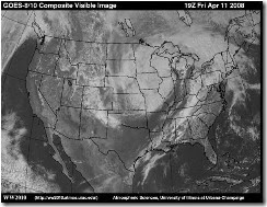
Weather Satellites that orbit the earth and take images of the clouds. Do you see the comma cloud in this satellite image from 2008? See how big this storm is? Just checking….

Picture1

Here is a satellite image from Thompson Learning. It shows that you can see different types of storms from space. Click on the image and you will see how thunderstorms, hurricanes and middle latitude storms (comma clouds) look.

Picture2

Soundings which show the conditions in the upper atmosphere. These are created by launching weather balloons with and instrument package attached called a radiosonde. The radiosonde is about the size of a soda can. It measures temperature, humidity, etc as it is carried aloft by the weather balloon. The information it collects is radioed back to someone on the ground. The information is then used to plot upper level maps and soundings. Here is what a sounding looks like. Unless you are a meteorologist you probably won’t be able to understand this graph. It has a lot of information on it. The only bad thing is that it is only done twice a day at midnight and noon GMT.

Meteograms are plots of the surface conditions over a 24 hour period. The plots show how temperature, dew point, pressure, winds, precip and clouds have changed during this time period at a specific location such as the Philadelphia airport. It is done for many locations. Here is the current meteogram for Boston. The little XX’s in yellow are snow. Boston was having snow almost the entire time period represented by this meteogram. If you want to understand how to read a meteogram go to this link.

met_KBOS

Radar shows the precipitation. It shows where the precip is, how heavy it is, and what kind it is. Here is the radar of the NE for today’s storm. I love the Weather Channel’s radar images. You can clearly see who is getting snow, freezing rain, and rain.

us_ne_4regradar_medium_usen

Thanks for reading. Next Monday I will discuss other methods of forecasting and see how they stack up against each other.

Chris

Friday, February 6, 2015

I have what I have….

How many times do I start a project and wonder if I have the “right” fabrics? Maybe I should go out and buy more….

My current project which is a king sized Amish ocean waves is no exception. As soon as I started cutting fabric I began to wonder if the fabrics and colors I had were good enough. The point of this project was to use up the solids in my stash and to have a quilt for our new bed in our new house in August. This was inspired by the quilt exhibit we saw last year in Boston called Quilts and Color. The exhibit was beautiful and my husband loved it. So what better way to use up my solids? Plus I have always wanted to make an ocean waves quilt.

Well I started cutting fabrics and  the usual doubts that I had the perfect fabrics in my stash began. But eventually I thought I better stop that thinking. The point was to use up my fabrics and not to buy more. So I decided “I have what I have….” I just have to keep going and shut off that nagging voice in my head. You know the one…the perfectionist.


So far I have 320 half square triangle blocks sewn. I think I have to make something over 900 total.  They are going to be 3 inch blocks. Don’t they look beautiful together? My husband said wow when he saw them. Plus I am sure he is pleased that I am using up fabric. I am making 8 half square triangle blocks at a time using Karen Walker’s method at Craftsy. I will have to buy some fabric for borders and backing, but that will come later. Lot of triangle blocks to make.


I am also using the Quilt in a Day half square triangle ruler to trim up the squares by only having to do 2 cuts. It is a very useful tool.


The ruler lined up with the seam line of the block before opening it up. I am cutting my squares to 3 1/2 inches so they will finish at 3 inches.


Making the 2 cuts with rotary cutter.


The block opened up, pressed and dog ears cut off.


Some of my stress of last week has gone away. My retirement has been sorted out. We decided to bite the bullet on the extra $6000 charge on the new house. My current house is going to be listed to sell today and has never been cleaner. I did finish the top from the Craftsy kit that I was working on. Now I have to decide if I am going to quilt it or send it out. I am tempted to send it out.

Do you have similar doubts when you start working on a project? Do you go an buy more fabric or do you use what you have?

Well I am off to sew another 80 blocks. Linking to Nina-Marie.

Thanks for reading….

Chris

Monday, February 2, 2015

Weather Monday 2/2/15 (Forecasting Part 1: putting the pieces together)

“Nothing is Ever as it Seems".”

Weather forecasting is much like making a quilt. To make a quilt you have to put all your skills, your vision, and the pieces together. In order to predict future weather, you have to put all your knowledge, skill, and intuition together. Both forecasting and quilt making can be difficult, but I think forecasting the weather is harder by far.


Weather is complex

How the atmosphere behaves is extremely complicated. Think about how hard it is to make a quilt with Y-seams compared to making a nine patch. Or how about dealing with getting the center of a mariner’s compass to lay flat and have all the seams meet perfectly. Weather forecasting is definitely not the nine patch.

You might think forecasting something like the high and low temperature would be a simple thing. it is actually not easy to forecast temperature.  The temperature depends on so many things that it becomes something that is hard to predict.

  • Temperature is controlled by how many clouds there are. Clouds keep us cooler during the day and warmer at night. So knowing the amount of cloud cover is essential to forecasting the temperature.
  • What air mass is moving into the area. Today we might be in a warm air mass, but tomorrow a cold air mass might move in. When will it move in? How cold is it in the air mass that is coming? Will we have clouds or not? How many clouds?
  • Do you live near water or inland away from water? If you live along the coast you know that your temperature does not vary much during the day. The high might reach 65 degrees during the day and drop to 57 degrees at night. However, if you live inland away from the coast your temperature during the day might get to 80 degrees on the same day and 65 degrees at night. Coastal cities have a smaller range in temperature than inland cities. And what if you live in a desert? It can get to over 100 during the day and drop to below freezing. Why? Lack of water and clouds.
  • Temperature varies with latitude and altitude. So the cities closer to the equator are different than cities closer to the poles. Also temperature decreases the higher up you go in the atmosphere. The temperature on a mountain top is colder than in the valley below. So more factors to take into consideration.
  • How many daylight hours is the city having? We get less daylight in the winter and more in the summer.
  • Do you have snow covering? Having the ground covered with snow makes it colder than if you did not have the snow covering.

So you can see that temperature is not simple and straight foreword. It is not as easy as making a simple nine patch block. So a weather person has a lot of pieces to put together to figure out what the temperature is going to be.

How accurate are forecasts?

You can’t believe how many times that once someone knows that I am a meteorologist I hear, “Forecasters are never right.” Well for sure they are not right all the time, but their accuracy is a lot better than most people realize. I think we have selective memory when it comes to that. We remember when they are wrong, but forget when they are right.

So how accurate are forecasts and how do you even measure accuracy? If they say the high temperature is going to be 70 degrees and it only reaches 68 is that accurate or not? If they say that all these areas are going to get a lot of snow and only 3/4 of these areas actually get a lot of snow is that accurate or not?  Yes I am talking about last week’s blizzard. NYC did not get the amount of snow forecasted, but Boston certainly did. I don’t thing people realize how hard it is to forecast a winter storm. I doubt we will ever be 100 % accurate.

Here is a website that calculates the accuracy of different forecasting sites like The Weather Channel, Accuweather, Weather Underground, etc.

Forecasting accuracy gets worse the further out in time you try to forecast for. 12 hour and 24 hour forecasts are the most accurate. I usually don’t pay attention to forecasts for more than 2 days out.   I will explain why in the next weather blog. So what this site measures is how accurate the temperature and precipitation forecast is for a 3 day forecast. That means what did the different forecasters say the temperature and precipitation was going to be 3 days later? And how accurate were they? So why just temperature and precip? Well to get temperature and precip  right you have to get lots of other things right. So they are a good test of accuracy.

What you will find if you go to this website is the accuracy varies a lot depending on the location. Some locations are easier to forecast for than others. For example:

  • NYC 75% accuracy
  • Boston 70% accuracy
  • San Francisco 82% accuracy
  • Phoenix 90% accuracy

So being a forecaster in Phoenix, Arizona is a lot easier than one in Boston, Mass. Of course you can also see that they are not always wrong. 75% accuracy for a 3 day forecast is pretty good. Certainly a lot better than tossing a coin.

So what about the groundhog?

Since today is Groundhog day I thought it would be a good day to bring Phil up. I guess he saw his shadow today.

Punxsutawney-Phil-screenshot

His accuracy is only 39%. So I would not rely on Phil. Forecasters have gotten better at doing longer range forecasts for determining what kind of winter we will have or what kind of hurricane season it will be.

Last winter and this winter they forecasted a bad winter for the east coast of the USA. Last winter we had a bad winter and this year is shaping up to be bad as well. Cold and lots of snow! Although generally we will know what the winter will be like after it is over!

So I leave you with this forecast from Accuweather! Enjoy!!!! I will be back next Monday with Part 2 on forecasting.

Picture1

Meanwhile thanks for reading. If you have any questions or comments just post them.

Chris